2.1 Location
Cape Baily Lighthouse is located approximately 17.5 kilometres south of the Sydney Central Business District. The lighthouse is situated within Kamay Botany Bay National Park’s Kurnell area. Lighthouse coordinates: 34º 2.2000'S, 151º 13.3000'E
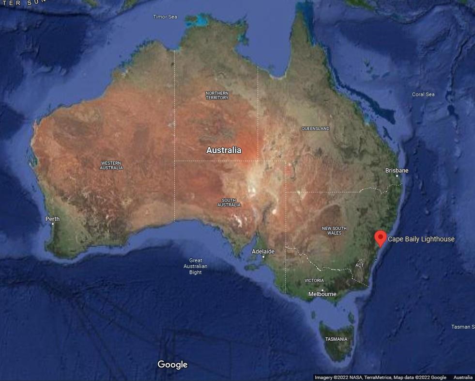 Figure 3. Location of Cape Baily Lighthouse along Australia's eastern coast (Imagery ©2022 NASA, TerraMetrics. Map data: ©2022 Google
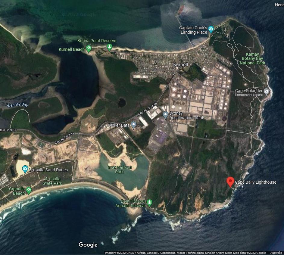 Figure 4. Location of Cape Baily Lighthouse within the national park (Imagery ©2022 CNES/Airbus, Landsat/Copernicus, Maxar Technologies, Sinclair Knight Merz. Map data: ©2022 Google)
2.2 Setting and landscape
Cape Baily Lighthouse is located on Kurnell Peninsula. The peninsula is dominated by heavy industrial plants including oil refineries and a large sewerage treatment plant. The coastline to the north and south is dominated by coastal cliffs.
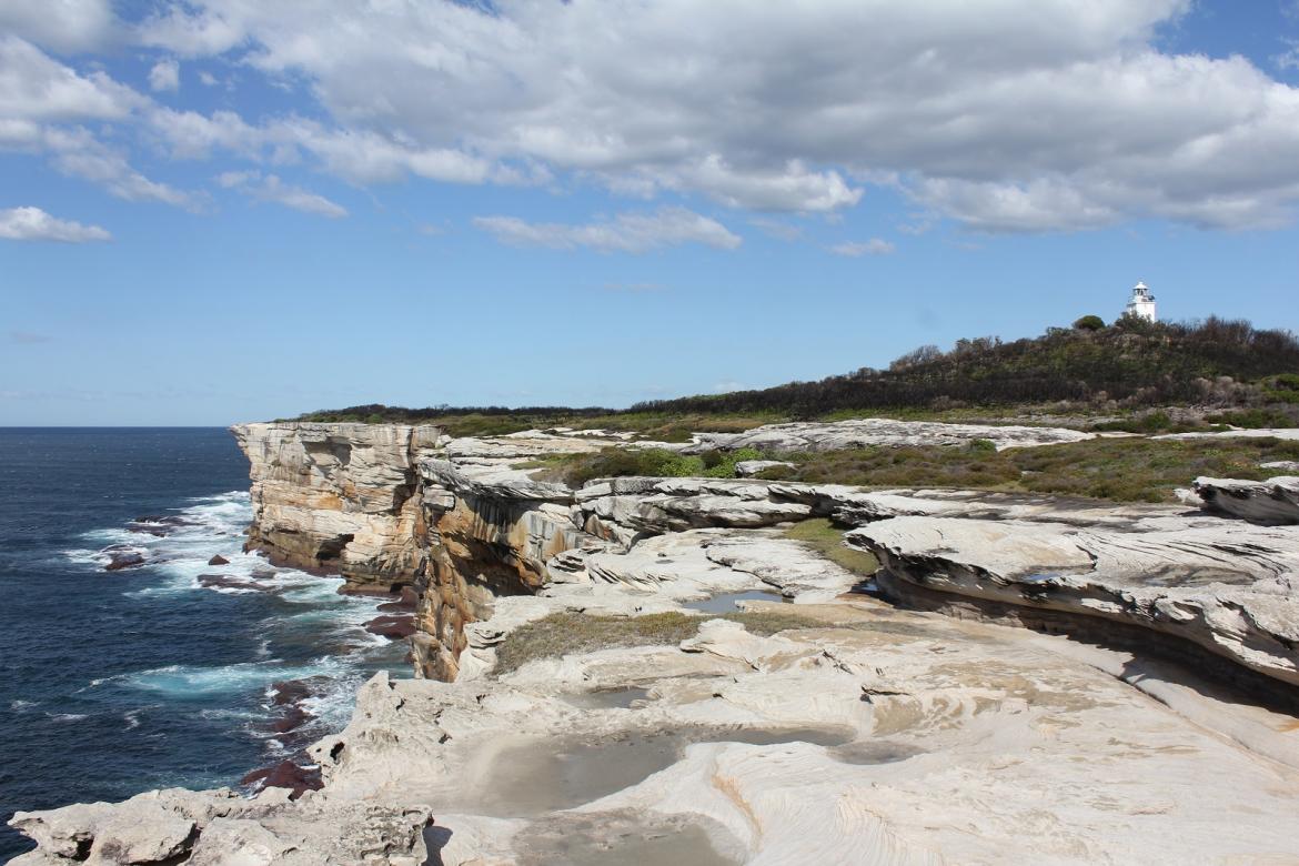 Figure 5. Cliffs by Cape Baily track (© AMSA, 2018)
Fauna and flora
The lighthouse is located in a fragile ecosystem within the Kamay Botany National Park. At the time this plan was written, the Park contained seven threatened plants specimens and eighteen threatened animals. The landscape is dominated by heath vegetation and sand dunes. The Eastern Suburbs Banksia Scrub Endangered Ecological Community is also recorded within the Park.
In 2020, the ‘Kamay Botany Bay National Park Plan of Management’ was released by the New South Wales State Government and can be accessed online:
In 2020, the ‘Kamay Botany Bay National Park Plan of Management’ was released by the New South Wales State Government and can be accessed online: http://www.environment.nsw.gov.au/resources/planmanagement/final/botany-bay-national-park-plan-management-1600376.pdf
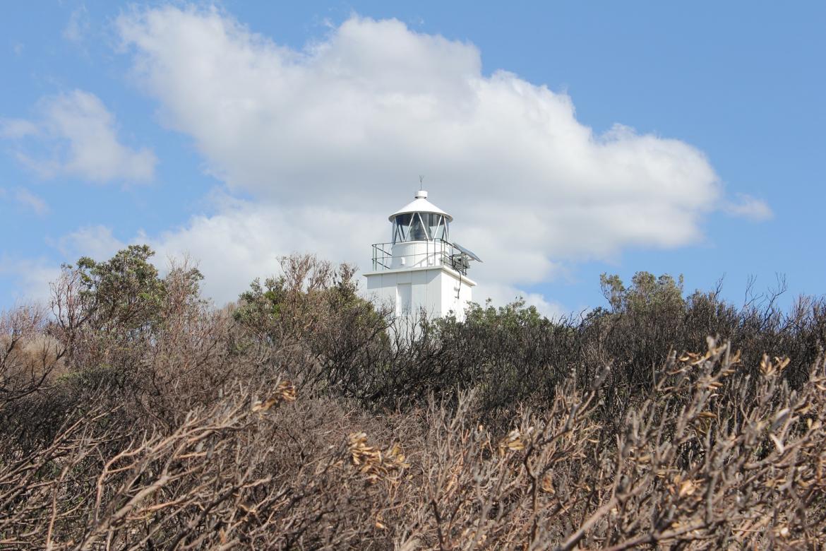 Figure 6. Vegetation by Cape Baily Lighthouse (© AMSA, 2018)
2.3 Lease
AMSA lease the Cape Baily Lighthouse and land from the NSW National Parks and Wildlife Service, the state body responsible for Kamay Botany Bay National Park.
The AMSA lease consists of a 930m2 parcel of land, which sits wholly within the Kamay Botany Bay National Park.
The current lease was signed on 1st July 1997 with the option to extend for a further 25 years. The lease provides a framework within which access rights are subject to negotiations between AMSA and NSW NPWS due to the fragility and erodibility of the site. AMSA must comply with the Kamay Botany Bay National Park Plan of Management.6
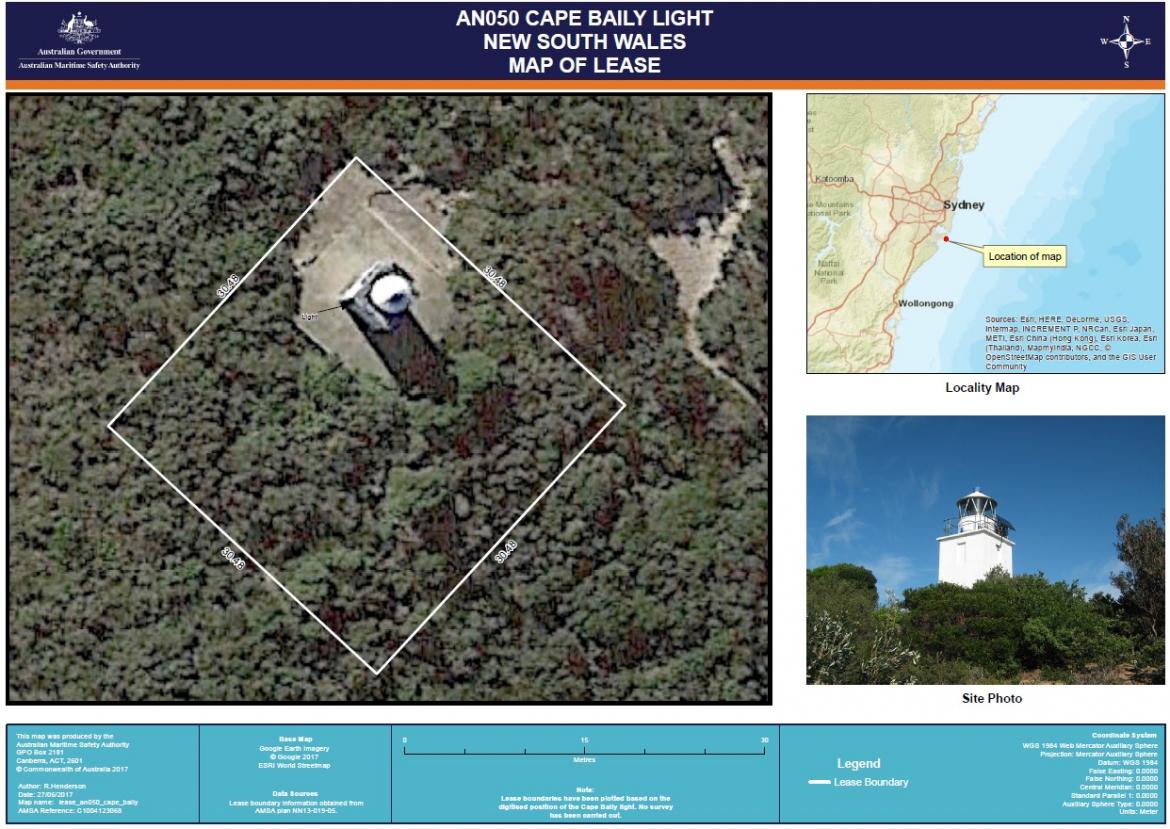 Figure 7. Cape Baily Lighthouse AMSA lease map (Google Earth Imagery ©2017 Google, ESRI World Streetmap)
2.4 Access
A vehicle access track exists from the Cronulla View carpark at Doughboy Head, it is approximately 1.4km each way. The access track is often overgrown with vegetation and is difficult to traverse in places.
The track is only accessible to service vehicles. All public access is by walking trails only. The last few hundred meters are required to be walked by all visitors.
The site is visited by AMSA maintenance contractors twice per year. Dependent upon works to be undertaken and track conditions a decision is made to either drive or walk.
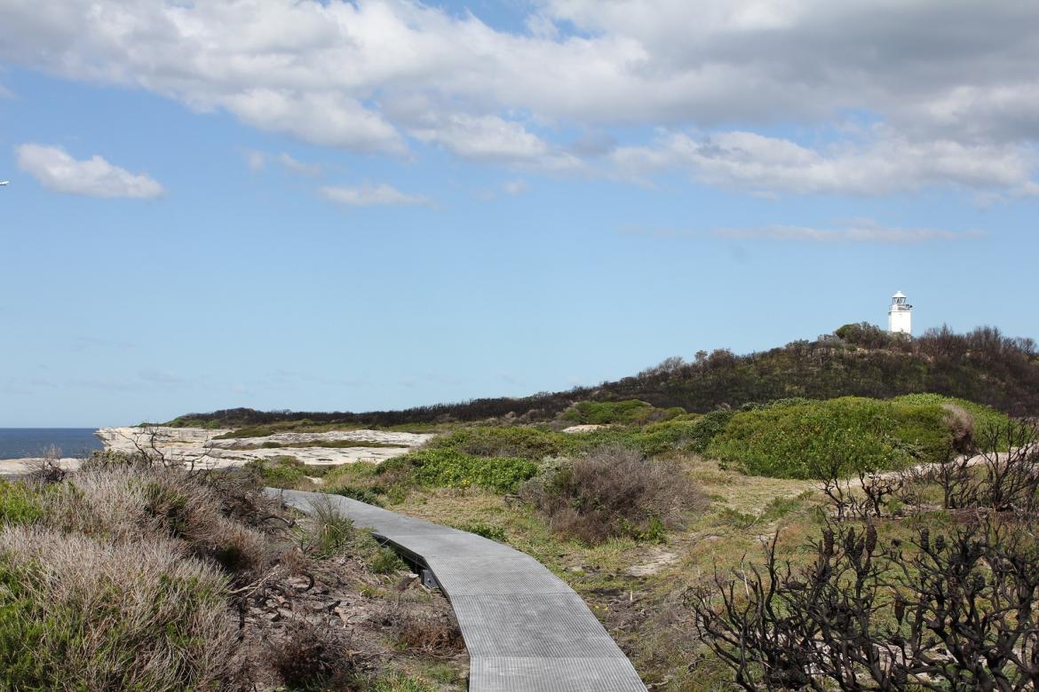 Figure 8. Pedestrian walking track to lighthouse (© AMSA, 2018)
2.5 Listings
Cape Baily Lighthouse is listed on the following heritage registers:
| List | ID |
| Commonwealth Heritage List | 1055717 |
| Register of the National Estate | 1029308 |
The Kurnell Peninsula Headland, on which the Cape Baily lighthouse is located, is listed on the National Heritage List as Place ID 1058129
___________________________________________________________________________________