2.1 Location
Sugarloaf Point Lighthouse is located within the Myall Lakes National Park, approximately 285 kilometres north of the Sydney central business district within the Myall Lakes National Park.
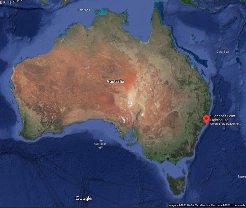 Figure 3. Location of Sugarloaf Point Lighthouse along Australian coastline (Map Data @2021 Google, NASA, TerraMetrics)
Lighthouse coordinates: 32° 26.4630’ S, 152° 32.3450’ E.
2.2 Setting and landscape
Sugarloaf Point Lighthouse is located on the eastern side of Sugarloaf Point. This area comprises the north–eastern portion of Myall Lakes National Park. Sugarloaf Point is a significant landmark along the coastline with views from the Lighthouse to Charlotte Head in the north and south to Broughton Island and Yacaaba Headland. The underlying geology reflected in the jagged and inclined rock platforms and sheer cliffs provides a strong character that dominates the environment.
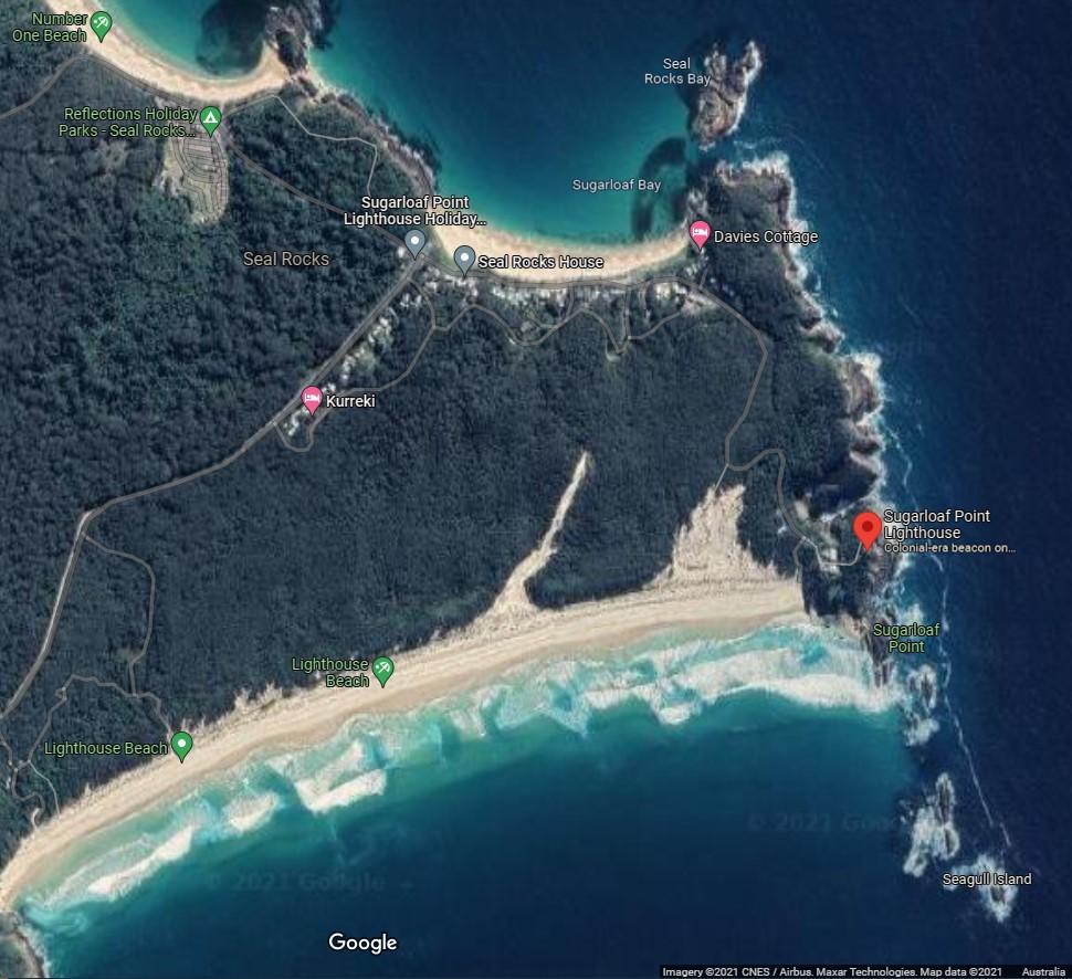 Figure 4. Map of Sugarloaf Point and surrounding Myall National Park (Map Data @2021 Google, CNES/Airbus, Maxar Technologies)
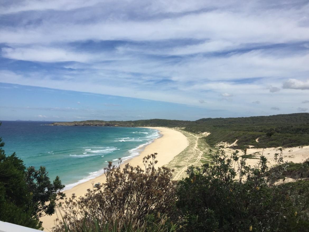 Figure 5. View of Lighthouse Beach from Sugarloaf Point Lightstation (© AMSA, 2019)
Fauna and flora
The headland consists of coastal forests and eucalypt woodlands with the associated dune vegetation communities behind the beaches. The vegetation along the cliffs is largely coastal heathland and shows evidence of the strong winds that sweep the peninsula. Weed infestation varies depending on the exposure to settlement patterns; particularly the vehicular tracks that link the area.
2.3 Lease
AMSA lease the lighthouse and a small parcel of land from the Minister administering the National Parks and Wildlife Act (NSW) through the NSW National Parks and Wildlife Service (NSW NPWS), the state body responsible for Myall Lakes National Park and larger Sugarloaf Point Lightstation complex.
There are two AMSA leases which cover Lot 1 (the lighthouse tower) and Lot 2 (access paths and the Signal hut) of DP847752, a land area of approximately 560 m2 which sits wholly within the Myall Lakes National Park. The current leases were signed on 1 July 1997, and both have an option for extension for a further 25 years.
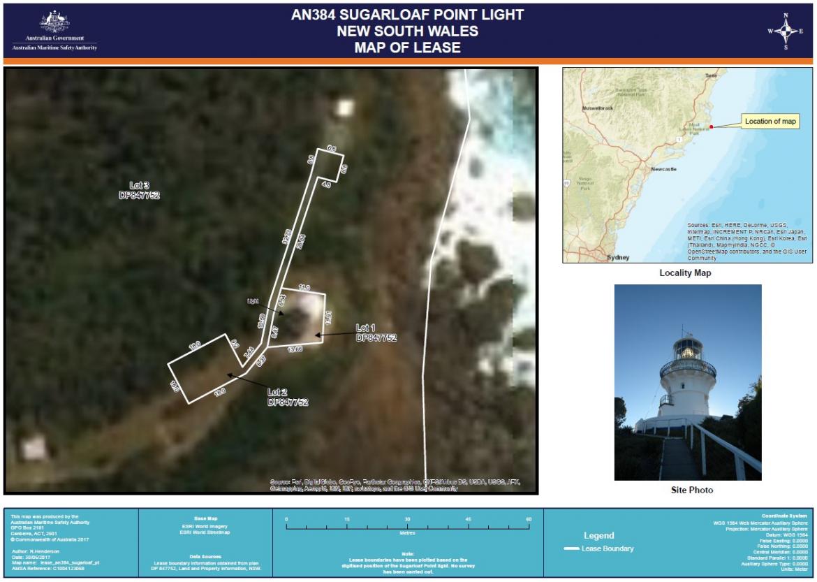 Figure 6. Sugarloaf Point Lighthouse AMSA Lease (Map data: Esri, DigitalGlobe, GeoEye, Earthstar Geographics, CNES/Airbus DS, USDA, USGS, AEX, Getmapping, Aerogrid, IGN, IGP, swisstope, GIS User Community)
NSW National Parks and Wildlife Service
AMSA maintains a collaborative working relationship with NSW NPWS. AMSA and NSW NPWS have coordinated the admittance of official tour groups for significant events at the lightstation throughout the 21st century.
Project works and works impacting the larger lightstation require prior notification, and access rights are subject to negotiations between AMSA and NSW NPWS due to the nature and location of the site. The lease also stipulates that AMSA must comply with any applicable management plan and State environmental laws. In the case of Sugarloaf Point, AMSA must comply with the Myall Lakes National Park Plan of Management for the precinct which can be found here.
2.4 Access
A sealed road runs from Seal Rocks village for approximately one kilometre to the lightstation, with vehicle access limited to service vehicles and holiday tenants of the Keeper’s cottages who can leave vehicles near the garages. General public access is by walking trails from Seal Rocks. The last few hundred meters up to the Lighthouse itself is pedestrian only.
Access to the Sugarloaf Point headland is via a sealed road that winds up from the Seal Rocks village to the keepers’ cottages. From the parking area in the village there is only pedestrian access for the public unless staying at the cottages. There is no vehicle access beyond the Keepers’ Quarters, only a sealed pedestrian way up to the Lighthouse. The Keepers’ trolley way is no longer in use.
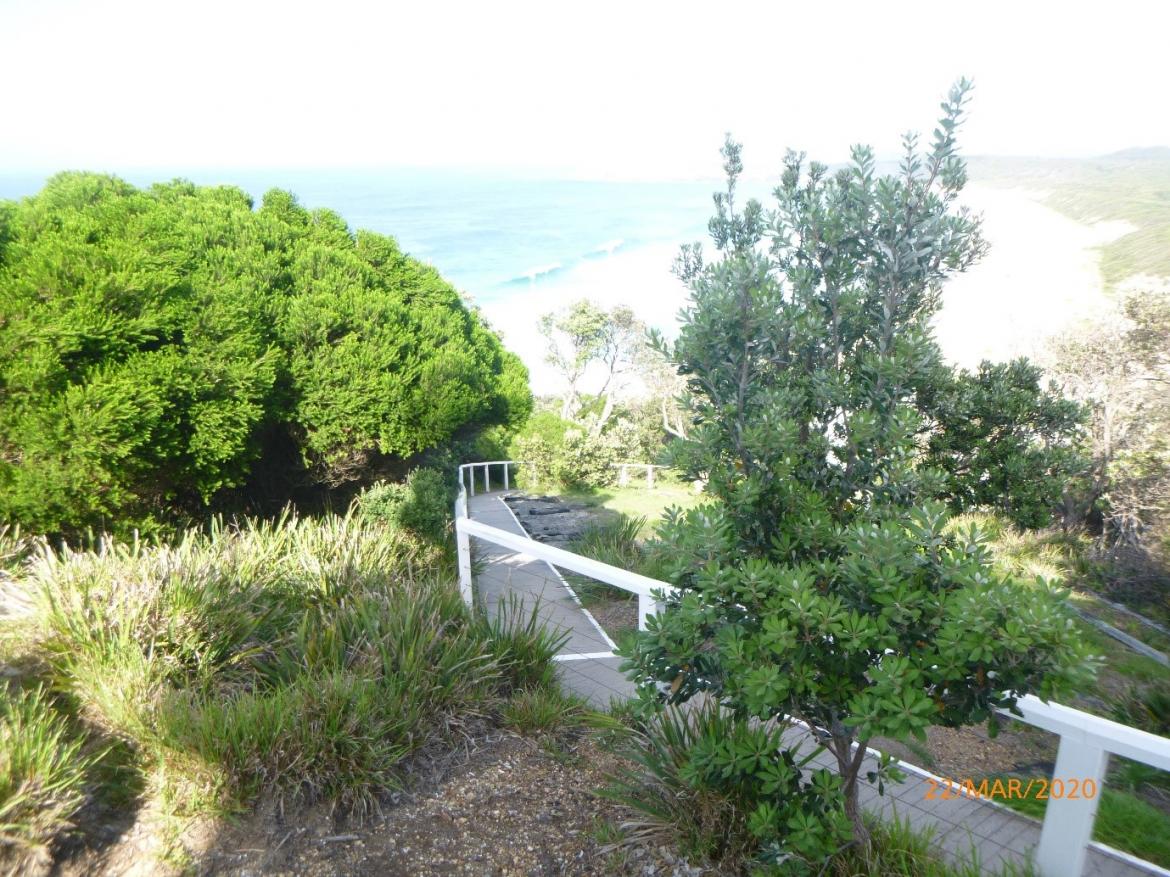 Figure 7. View of pedestrian access way to Sugarloaf Point Lighthouse (© AMSA, 2020)
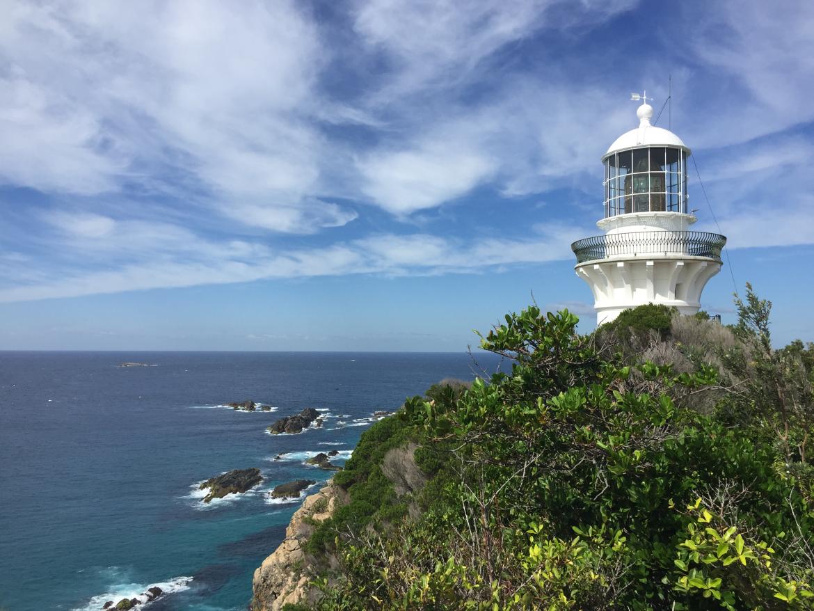 Figure 8. Sugarloaf Point Lighthouse (© AMSA 2019)
2.5 Listings
Sugarloaf Point Lighthouse is listed on the following heritage registers:
List | ID |
Commonwealth Heritage List | 1056029 |
Register of the National Estate | 10360410 |
NSW State Heritage Register | 0202511 |
The place is also located in local government area “Great Lakes region” within the Mid-Coast Council and is listed in the Great Lakes Local Environment Plan as Local Heritage Item number I30.
Footnotes
11 “Sugarloaf Point Lightstation Group,” New South Wales State Heritage Register