- Marine Order 54 (Torres Strait Draught Variation) – Exemption 2021;
- UKCM system usage;
- Positioning the UKCM system as an Aid to Navigation;
- Key UKCM system functionality; and
- AMSA’s approach to UKC regulation.
Update
Marine Order 54 (Coastal pilotage) 2014 (MO54) requires AMSA-licensed coastal pilots to use the UKCM system to support the pilotage of vessels through Varzin Passage, Gannet Passage and the Prince of Wales Channel (PoWC). In parallel, pilotage providers that assign pilots to conduct these transits are required to ensure the pilots use the UKCM system, in accordance with their licence conditions.
AMSA’s assessment of transit data recorded since the UKCM system’s introduction, along with data associated with various deep-draught UKCM system trials conducted since 2016, identified that the previously established system usage framework, could be safely adjusted under certain conditions.
Such adjustments, including those related to the minimum vessel draught applicable for UKCM system usage, and an increase to the maximum vessel draught permitted to transit Torres Strait, would also provide greater flexibility to pilots and pilotage providers regarding use of the UKCM system.
Accordingly, Marine Order 54 (Torres Strait Draught Variation) – Exemption 2021, issued on 08 October 2021, outlines the UKCM system is to be used for transits through Varzin Passage, Gannet Passage and the PoWC, for vessels with draughts of 9m or more, up to a maximum draught of 12.5m.
For vessels with draughts between 8m and 9m, where any speed may be greater than the maximum default planned speed for a particular location, coastal pilots are encouraged to continue to have a transit plan generated in the UKCM system. Doing so ensures the transit can be safely executed to the pilot’s satisfaction, taking into account the environmental factors forecast for the time of transit.
For vessels with draughts >12.2m, pilotage providers and coastal pilots are reminded that a UKCM system ‘transit window’ for these vessels may not exist all year-round. Transits planned for draughts >12.2m need to be carefully planned, taking into account the risk that forecast tides may not achieve the predicted levels and the impact that this could have on the next available window for a vessel’s transit of the UKCM area.
System usage
AMSA-licensed coastal pilots are reminded that use of the UKCM system includes:
- ensuring a Transit Plan is activated for the correct vessel before entering the UKC corridor; and
- ensuring the minimum under keel clearance (UKC) requirements, as specified in MO54, are managed whilst transiting the areas mentioned above.
UKCM system as an Aid to Navigation (AtoN)
AMSA considers the UKCM system to be an AtoN which supports safe navigational practices. As with all AtoN, use of the UKCM system should be seen as one of many means available to ensure spatial and situational awareness, to assist with onboard navigational decision-making. Use of the UKCM system should not limit the use of other AtoN that may also be available to the mariner.
The following points should be borne in mind by all UKCM system users:
- The ‘Voyage Planning’ service provides a broad, long-term indication of suitable tidal ‘windows of opportunity’ for potential transits;
- The ‘Voyage Planning’ service supports long-term planning only and does not incorporate any short-term, or real-time met-ocean data;
- The ‘Transit Planning’ service should be used to generate transit plans for coastal pilotage purposes. Transit plans can be generated up to five days before the planned transit, and can be made ‘Active’ at any point within this five-day window;
- Both ‘Draft’ and ‘Active’ transit plans are continuously updated to incorporate real-time met-ocean data;
- Making the intended transit plan active, ensures the ‘Transit Monitoring’ facility will commence once the vessel has been detected in the UKCM system monitoring area.
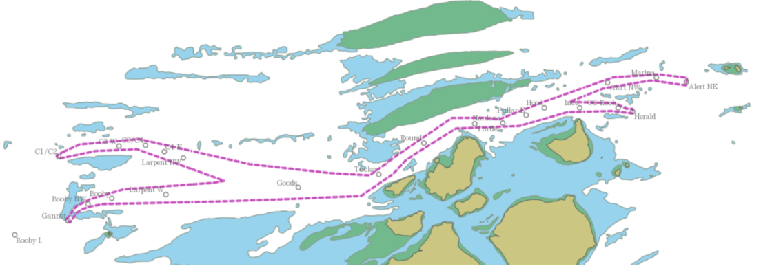
- Even if a transit plan is not activated sooner, it must be activated before entering the UKCM system corridor (indicated by the pecked magenta polygon in Figure 1 below).
- The timing of a vessel’s entry into the UKCM system corridor, should be accurately reflected in the active transit plan. This may require a coastal pilot to update the transit plan on approach to the UKCM system corridor;
- The selection of a UKCM system ‘Deep Route’ option, ensures the UKCM system incorporates the deepest channel depths possible. This is relevant for transits of vessels with draughts that limit their route options;
- UKCM system transit plans and routes can be edited while underway. If a pilot changes the planned route during the transit, they should perform a new UKCM system calculation to reflect the amended route. This ensures correct UKC data for the new route is provided to the pilot.
- To assist with data integrity across systems, coastal pilots are encouraged to verify that a vessel’s AIS settings accurately reflect the vessel’s actual deepest draught (as input into the UKCM system) before entering the UKCM system monitoring area.
- While trainee pilots are encouraged to become familiar with the UKCM system as part of their coastal pilot training, their names should not be attributed to UKCM system transits for vessels ≥9m, until they have attained a restricted coastal pilot licence and successfully completed the UKCM system practical assessment, conducted by AMSA.
Key UKCM system functionality
The UKCM system uses high resolution bathymetric data from the Australian Hydrographic Office. This data is periodically updated and underpins the UKCM system’s calculations, including the ‘chart overlay’ feature and UKC ‘warning layer’ included in the UKCM system. These features provide pilots with important information about the available water column within the UKCM monitoring area.
Chart overlay data is represented by red pixelation in the individual transit monitoring display for vessels. The red pixelation equates to areas where the UKCM system has calculated that AMSA’s minimum UKC requirement cannot be satisfied, taking into account the current environmental conditions and the observed / calculated speed of the vessel through the water.
The UKC warning layer data is represented by amber pixelation in the individual transit monitoring display for vessels. The amber pixelation equates to areas where the calculated UKC is between the AMSA’s minimum UKC requirement, and 0.2m above AMSA’s minimum UKC requirement. The amber pixelation generally reflects areas where the water is shallowing over time. Again, the amber warning layer is based on the current environmental conditions and the observed / calculated speed of the vessel through the water.
Data for vessels with an ‘active’ transit plan is updated every 30 seconds whilst in the UKC corridor. This ensures that near real-time information about the existing and predicted water column is provided throughout a vessel’s transit.
Coastal pilots are also reminded that the named UKCM system waypoints are unique to the UKCM system and, whilst frequently located adjacent to the Queensland Coastal Passage Plan (QCPP) waypoints, they should not be construed as being coincident with QCPP waypoints.
Whilst the QCPP provides recommended routes for transits of Torres Strait, coastal pilots should remain aware of the proximity of the UKCM system Deep Route boundary to the QCPP recommended track(s), particularly in the vicinity of Sunk Reefs in the PoWC.
Where possible, coastal pilots of deep-draught vessels using the UKCM system ‘Deep Route’ option, should consider safely adjusting their planned track(s), to ensure the deep-draught vessel remains within the UKCM system ‘Deep Route’ boundary, throughout the transit.
Regulation
MO54 includes scope for potential regulatory action against coastal pilots and pilotage providers for breaches of AMSA’s UKC system usage requirements.
Whilst UKCM system-calculated UKC values will be a relevant consideration in any potential proposed action, AMSA expects coastal pilots to exercise their professional judgment at all times while transiting Torres Strait and whilst using the UKCM system as required.
AMSA will consider all relevant aspects in forming a decision about possible regulatory action related to any alleged breach. This will ensure the combined elements of UKC (eg. vessel speed, the location of the vessel within the channel), together with interactions with other vessels, and any other relevant operational and/or navigational matters are considered, as a whole.
This approach to regulation will consider the pilot’s overall management of the safety of the vessel and the environment, using all available means and in accordance with the provisions of MO54.
AMSA’s Compliance and Enforcement Policy includes engagement and education as options for encouraging compliance. For example, where it is appropriate to do so, AMSA may consider using various means of post-transit analysis to inform and assist coastal pilots’ understanding of any particular UKCM system related issue, as observed.
Further information
Further information related to AMSA’s UKCM system can be obtained from:
- www.amsa.gov.au/safety-navigation/navigating-coastal-waters/under-keel-clearance-management-coastal-pilots
- AMSA’s UKCM system website: https://dukc.omcinternational.com
Please forward any queries about the information contained in this PAN to:
Senior Advisor – Certification and UKC via email to coastal.pilotage@amsa.gov.au, or phone 07 3001 6831.
Download UKCM System Usage - Pilot Advisory Note (PAN) 02_2022