2.1 Location
Cape du Couedic Lighthouse lies off the coast of South Australia on Kangaroo Island. As Australia’s third-largest island, Kangaroo Island is approximately 4405 kilometres-squared in size with its largest settlement being the township of Kingscote on the north-eastern coast. The lighthouse is located on the far south-western shore of Kangaroo Island on Cape du Couedic Road, approximately 95.2 kilometres south-west of Kingscote, and approximately 209.9 kilometres south-west of South Australia’s capital city, Adelaide.
Lighthouse coordinates: 36° 03.4780' S, 136° 42.3250' E
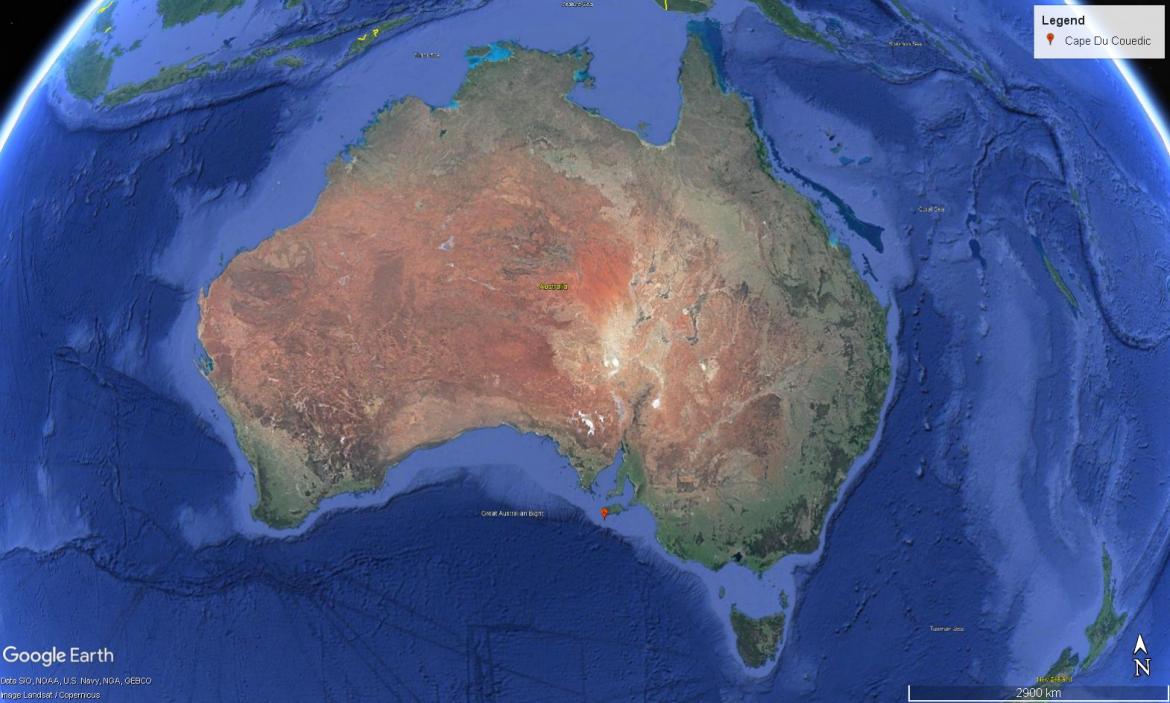 Figure 3. Location of Cape du Couedic Lighthouse within Australia (Map data: Google Earth, SIO, NOAA, U.S. Navy, NGA, GEBCO. Image: Landsat/Copernicus)
2.2 Setting and landscape
The lighthouse is situated within Flinders Chase National Park. Comprised of three parcels of land, the park has an area of approximately 326.61 kilometres-squared. The park is classified as an International Union for the Conservation of Nature Category II Protected Area.
Fauna and flora
Kangaroo Island is considered a sanctuary for a number of floral and faunal species. Most species observed today were introduced around the turn of the 20th century.
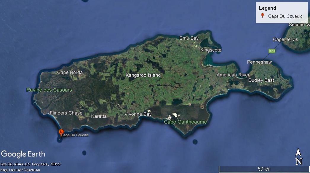 Figure 4. Location of Cape du Couedic Lighthouse along Kangaroo Island coast (Map data: Google Earth, SIO, NOAA, U.S. Navy, NGA, GEBCO. Image: Landsat/Copernicus)
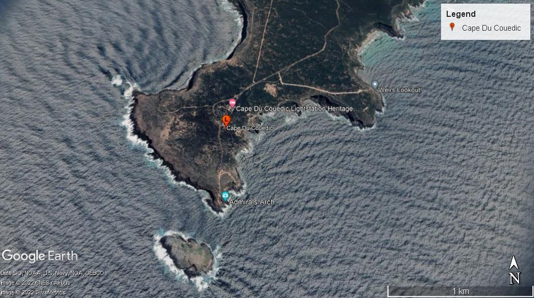 Figure 5. Location of lighthouse on Cape du Couedic (Map data: Google Earth, SIO, NOAA, U.S. Navy, NGA, GEBCO. Image: © 2022 CNES/Airbus, © 2022 TerraMetrics)
Faunal species include:
- Tammar wallaby (Macropus eugenii)
- Platypus (Ornithorhynchus anatinus)
- Koala (Phascolarctos cinereus)
- New Zealand fur-seal (Arctocephalus forsteri)
- Western grey kangaroo (Macropus fuliginosus fuliginosus)
Bird species on Kangaroo Island include:
- Glossy black cockatoo (Calyptorhynchus lathami)
- White-bellied sea-eagle (Haliaeetus leucogaster)
- Osprey (Pandion haliaetus)
- Bush stone-curlew (Burhinus grallarius)
- Australian bittern (Botaurus poiciloptilus)
- Shy heath-wren (Hyacola cauta)
- Bassian thrush (Zoothera lunulata)
- Shining bronze-cuckoo (Chrysococcyx lucidus)
- Hooded plover (Thinornis rubricollis)
- Cape Barren goose (Cereopis novaehollandiae)
- Fairy tern (Sterna nereis)
Various feral species such as goat, pig and cat exist on the island with various strategies in place to contain such populations.
Native floral species on Kangaroo Island include:
- Late donky orchid (Diuris brevifolia)
- Kangaroo Island daisy (Achnophora tatei)
- Twining finger flower (Cheiranthera volubilis)
- Island logania (Logania insularis)
Further information on the fauna and flora of Kangaroo Island can be accessed from the ‘Flinders Chase National Park, Kelly Hill Conservation Park, Ravine des Casoars Wilderness Protection Area and Cape Bouguer Wilderness Protection Area Management Plans’.5
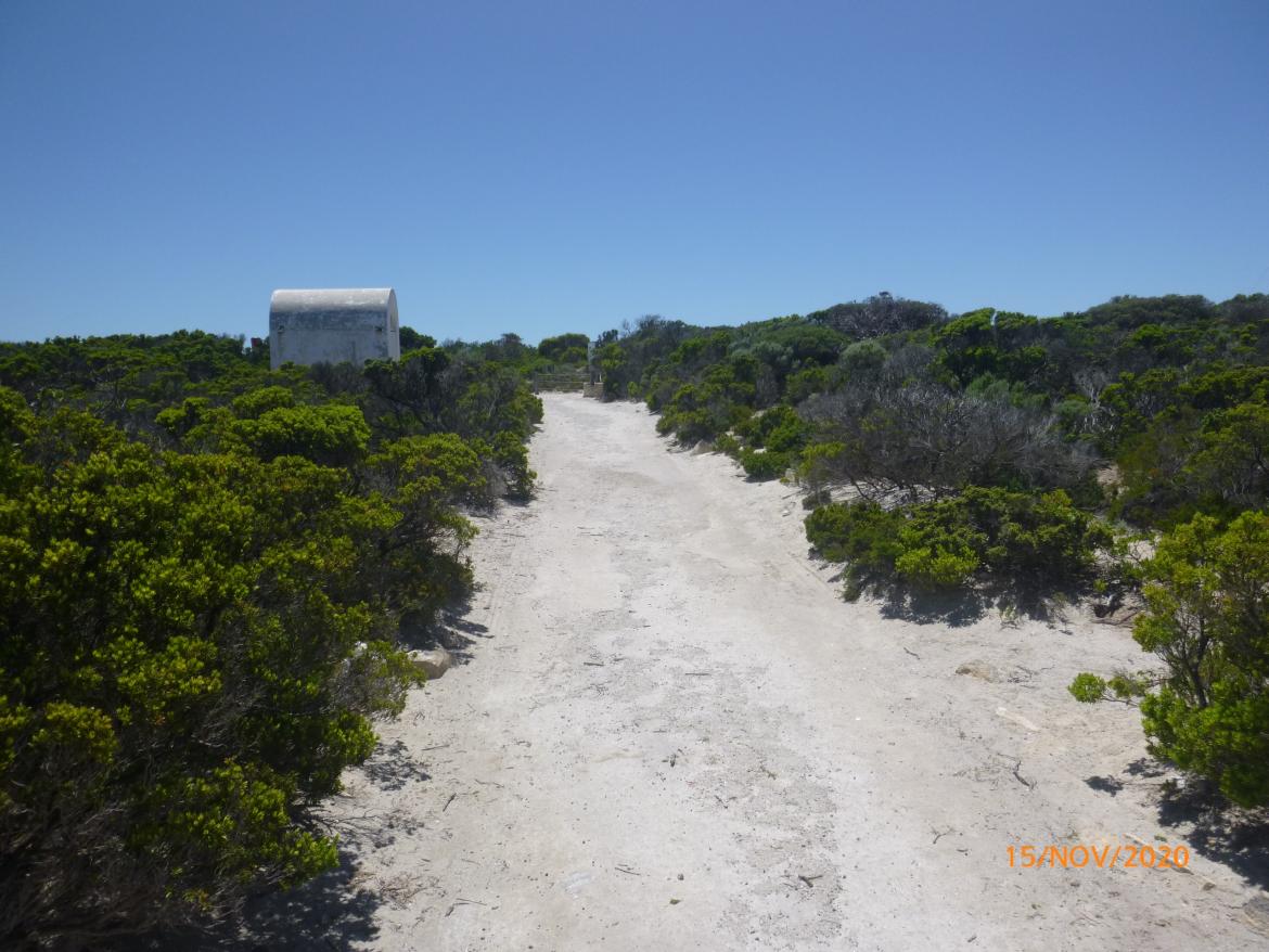 Figure 6. Surrounding vegetation on Cape du Couedic (© AMSA, 2020)
2.3 Lease and ownership
AMSA lease the lighthouse and land from the SA Department for Environment and Water (DEW), the state body responsible for Flinders Chase National Park.
The AMSA lease consists of two parcels of land:
- Lot A: GP 608/1993
- Lot B: GP 608/1993 (approximately 100 meter-squared)
The lighthouse tower sits within Lot B. The current lease was signed 8 December 1993. The current lease was signed 8 December 1993. The lease stipulates that AMSA must comply with any applicable management plan and State environmental laws. In the case of Cape du Couedic, AMSA must comply with the Flinders Chase National Park, Kelly Hill Conservation Park, Ravine des Casoars Wilderness Protection Area and Cape Bouguer Wilderness Protection Area Plan of Management.6
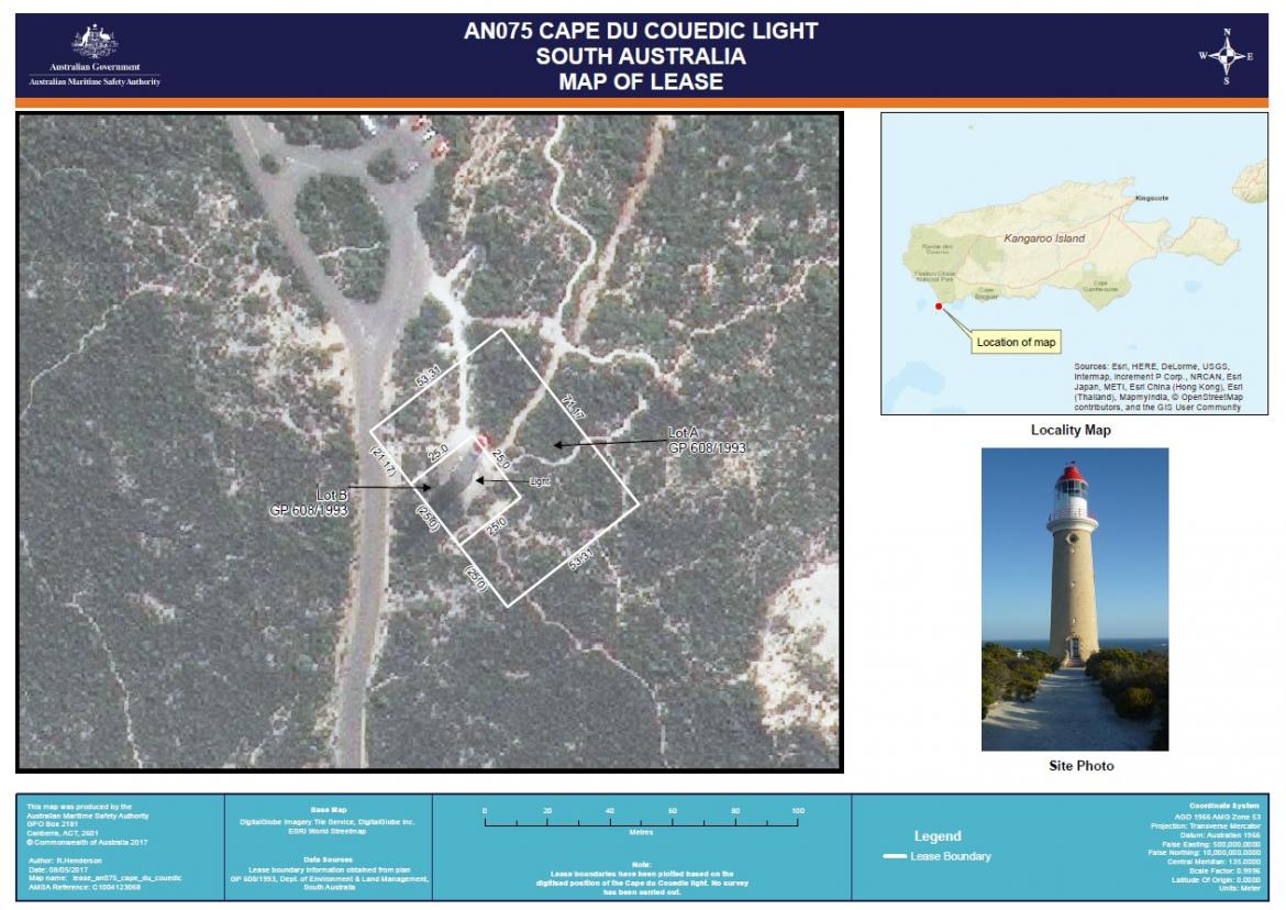 Figure 7. Cape du Couedic Lighthouse Map of Lease, 2017 (Map data: DigitalGlobe Imagery Tile Service, DigitalGlobe Inc. ESRI World Streetmap)
2.4 Access
Kangaroo Island can be accessed by either ferry or authorised plane/helicopter. Sealed roads are found across the Island. A sealed road, Cape du Couedic Road, runs to the lightstation with parking available. Pedestrians are required to travel approximately 60 metres from the road along Lighthouse Heritage Walk to reach the foot of the tower.
Cape du Couedic Lighthouse is not currently open to the general public, and access inside the lighthouse is restricted to authorised personnel only.
2.5 Listings
Cape du Couedic Lighthouse is listed on the following heritage registers:
| List | ID |
| Commonwealth Heritage List | 1054147 |
| South Australian Heritage Register | 103988 |
| Register of the National Estate | 74369 |
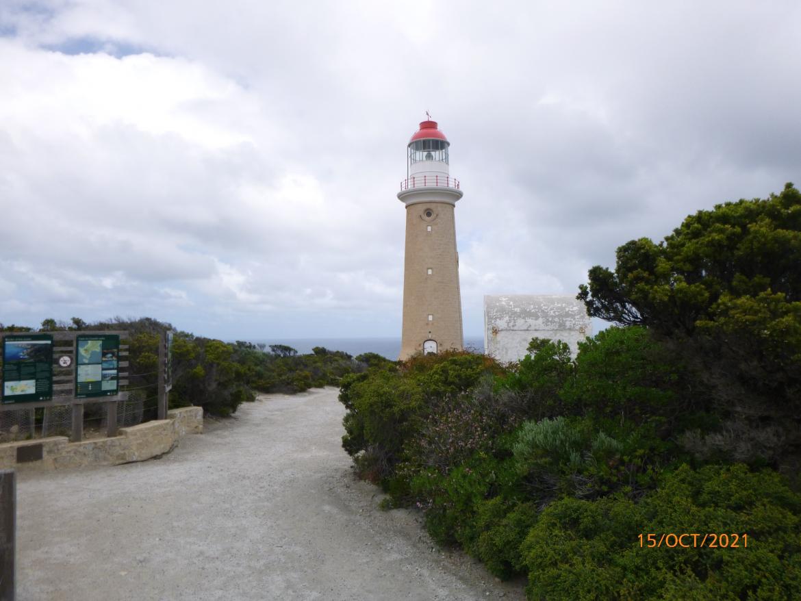 Figure 8. Access path to Cape du Couedic Lighthouse tower (© AMSA, 2021)
______________________________________________________________________________________________
Footnotes
![]() 5 Department for Environment, Heritage and Aboriginal Affairs, Flinders Chase National Parl, Kelly Hill Conservation Park, Ravine des Casoars Wilderness Protection Area and Cape Bouguer Wilderness Protection Area Management Plans (State Government of South Australia, 2000).
5 Department for Environment, Heritage and Aboriginal Affairs, Flinders Chase National Parl, Kelly Hill Conservation Park, Ravine des Casoars Wilderness Protection Area and Cape Bouguer Wilderness Protection Area Management Plans (State Government of South Australia, 2000).
6 Department for Environment, Heritage and Aboriginal Affairs, Flinders Chase National Parl, Kelly Hill Conservation Park, Ravine des Casoars Wilderness Protection Area and Cape Bouguer Wilderness Protection Area Management Plans.