About SBAS
Global Navigation Satellite Systems (GNSS) have become the primary means of obtaining Position, Navigation and Timing (PNT) information at sea. Most ships are equipped with GNSS receivers. A GNSS or an equivalent radio navigation receiver, is a SOLAS carriage requirement (Ch V/Reg.19.2.1.6). The United States-operated Global Positioning System (GPS) is a prime example of a GNSS.
Traditionally, navigators have relied on the marine radio beacon DGPS (Differential GPS) augmentation service, to improve positional accuracy and provide integrity monitoring for GPS signals. Integrity monitoring helps GPS receivers identify and discard signals from ‘unhealthy’ satellites. However, DGPS is a 1990s technology, and its coverage is limited to medium frequency radio ranges. AMSA discontinued its DGPS service in 2020.
SBAS has now replaced DGPS in Australia. There is no carriage requirement for SBAS in SOLAS.
Southern Positioning Augmentation Network (SouthPAN)
The joint Australia and New Zealand government operated SBAS is named Southern Positioning Augmentation Network or SouthPAN.
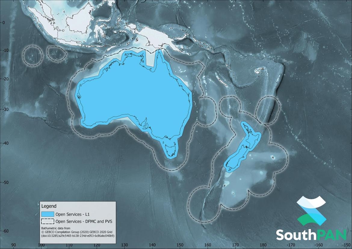
SouthPAN will improve the accuracy, availability and integrity of PNT information for users in the region. It now delivers early Open Services, free of user charges. SouthPAN provides accurate, reliable and instant augmentation of PNT information across all of Australia and New Zealand (see diagram). For example, the horizontal accuracy provided is several times better than the current unaugmented GNSS accuracy of about 10 metres.
With early Open Services now live, Australia and New Zealand are working towards full Open Services capability and an International Civil Aviation Organization (ICAO) certified Safety-Of-Life Services (primarily for aviation use) by 2028.
How can I receive SBAS signals?
You will need a SBAS-enabled GNSS receiver to use SouthPAN’s three early Open Services. It is likely such receivers will need to be configured to receive the correct types of messages from SouthPAN. You should check with the manufacturer of your receiver to know more about its capabilities.
For more information about SouthPAN’s early Open Services, please go to the the GeoScience Australia website to see the SouthPAN Fact Sheet.
Coverage
The L1 SBAS early Open Service is available within the light blue area shown in the diagram below.
The Dual Frequency Multi Constellation (DFMC) and Precise Point Positioning (PVS) early Open Services are available within the dotted lines.
More information
For more information and updates on SouthPAN, please visit Geoscience Australia.