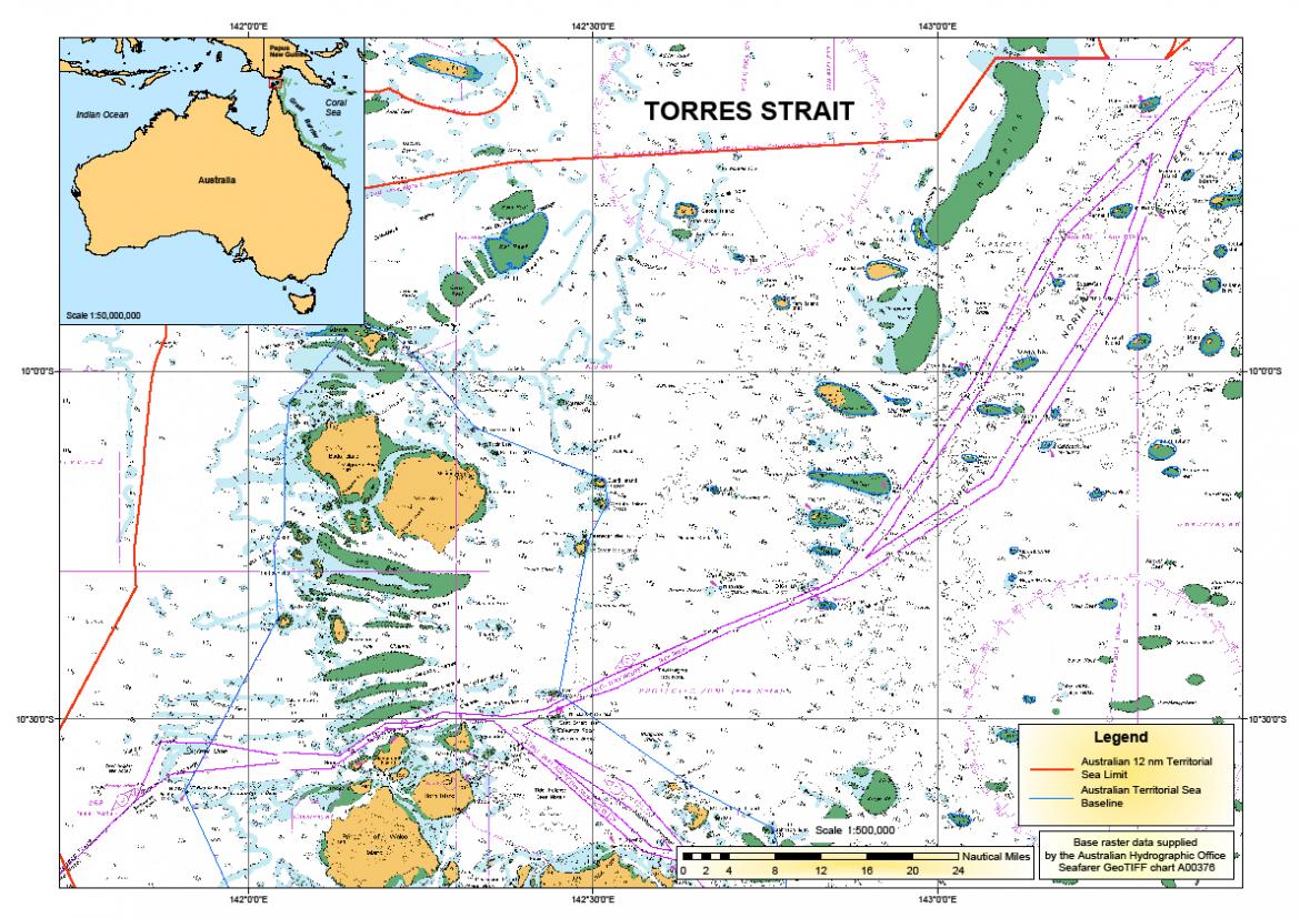
Environmentally fragile areas such as the Great Barrier Reef and the Torres Strait are considered particularly sensitive sea areas. We have mandatory regulations you must follow when navigating through these areas.
The International Maritime Organization's Maritime Safety Committee adopted a two-way route in the Great Barrier Reef and Torres Strait in 2014. This important measure was take to protect the environmentally sensitive waters of the region.
This ship routeing measure aims to reduce the risk of collisions and groundings by encouraging ships to follow well defined lanes.
Marine navigation is planning, managing and directing a vessel's voyage. The practice of marine navigation involves:
good seamanship
professional knowledge and judgement
the application of science and technology.
We deal with the safety of navigation in Australian waters by continually reviewing the effectiveness of current safety, navigation and management measures, and identifying additional or enhanced measures that may be needed in the future. Our long term plan, Navigation services in Australian Waters, identifies our top five priorities for navigational services and the principles we will use to deliver those priorities.
Navigation services
We deliver a range of navigational services for the commercial shipping industry.
These services provide ships with the ability to navigate safely around Australia’s coastline and to and from its ports. Services include:
a network of some 500 visual and electronic aids to navigation
ship routeing systems
ship reporting systems
an Under Keel Clearance Management (UKCM) system
The provision of navigational services is funded from the Marine Navigation Levy, a charge levied on the commercial levy-paying shipping industry.
E-navigation
E-navigation is an International Maritime Organization (IMO) led initiative that aims to harmonise marine navigation systems and provide information in electronic formats to a ship’s bridge team. It also aims to streamline the way maritime authorities, agencies and other stakeholders gather and exchange navigation-related information.
Globally harmonised maritime information services will be an integral part of e-navigation, which will contribute to enhancing the safety and efficiency of shipping.
Australia has been active in three areas that are integral to the future of e-navigation:
Human Centred Design (HCD) of navigation equipment
Development of IMO guidance on the standardisation of functions and display of navigation equipment (aka 'S-Mode')
Positioning, Navigation and Timing (PNT) services.
Based on collaborative international efforts led by Australia, IMO approved a Guideline on Software Quality Assurance and Human Centres Design for e-navigation in 2015. We have also produced an information video which introduces the guideline.
IMO is progressing several e-navigation outputs. The International Association for Marine Aids to Navigation (IALA) is progressing the shore aspects of e-navigation. We will continue to contribute to these international endeavours.
Australia’s submission to the IMO—Identification of the Great Barrier Reef as a particularly sensitive sea area—MEPC 30/19/4 PDF1.59 MB
Resolution—Identification of the Great Barrier Reef as a particularly sensitive sea area—MEPC.44(30) PDF88.98 KB
Australia/Papua New Guinea submission to IMO—Extension of existing Great Barrier Reef PSSA to include the Torres Strait Region—MEPC 49/8 PDF923.34 KB
Resolution 'Designation of the Torres Strait as an Extension of the Great Barrier Reef Particularly Sensitive Sea Area'—MEPC.133(53) PDF248.6 KB
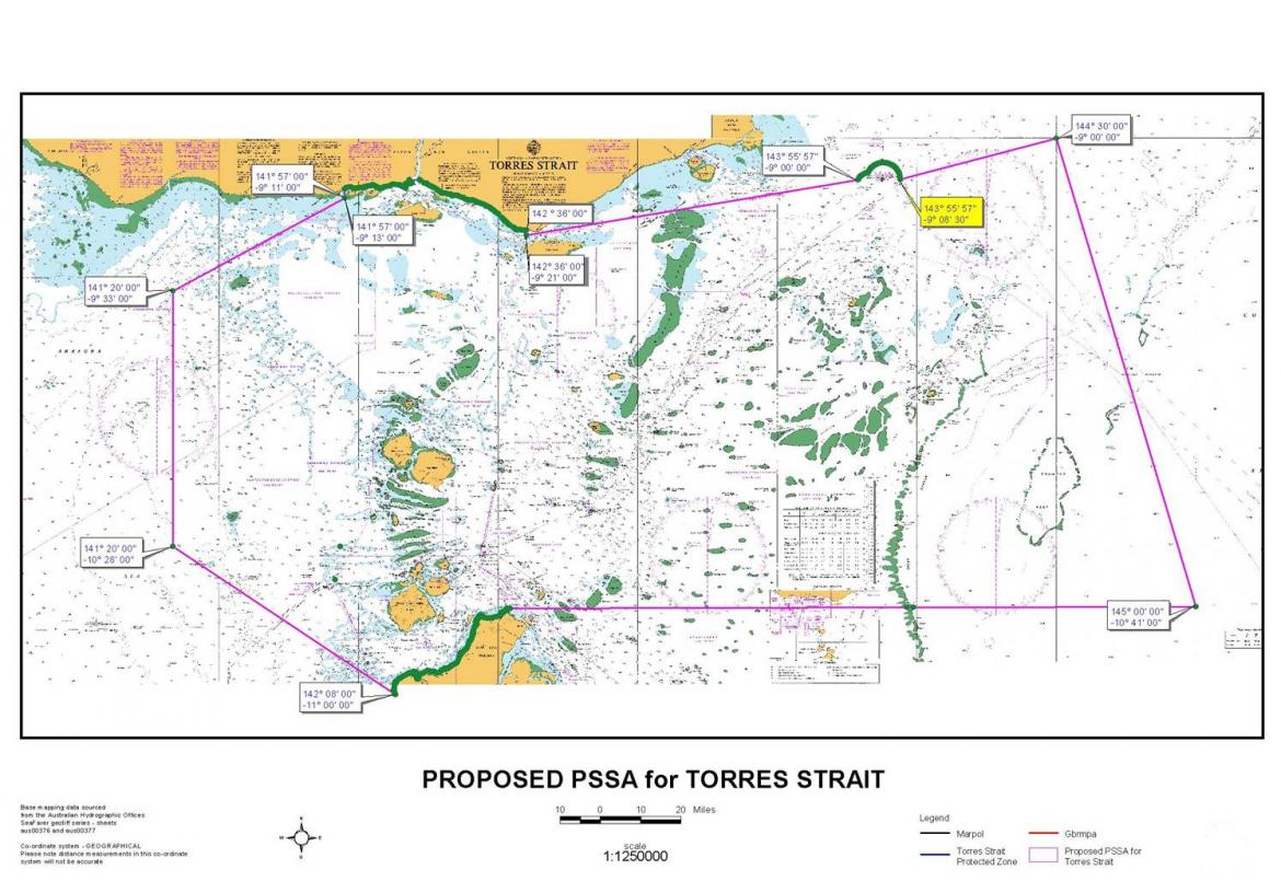
Australia’s submission to the IMO—'Extension of the Great Barrier Reef and Torres Strait PSSA to include the south-west part of the Coral Sea'—MEPC 68/10/1 PDF4.39 MB
Resolution 'Designating the south-west part of the Coral Sea as an extension to the Great Barrier Reef and Torres Strait PSSA'—MEPC.268(68) PDF1.41 MB
A PSSA is designated because of its significance for recognised ecological, socio-economic, cultural heritage or scientific attributes that may be at risk of damage from international shipping activities. A PSSA is supported by associated protective measures (APMs). APMs are designed to prevent, reduce, or eliminate risks.
Designation of the Great Barrier Reef, Torres Strait, and Coral Sea PSSA
The Great Barrier Reef was placed on the World Heritage List in 1981. The International Maritime Organization (IMO) designated the Great Barrier Reef as the world’s first PSSA in November 1990. This designation recognised the risks posed by ships transiting the waters of the Great Barrier Reef. It provided additional protection for the outstanding natural qualities of the area.
In 2005, following submissions to the IMO by the Australia and Papua New Guinea governments, the Great Barrier Reef PSSA was extended. The extension to include the Torres Strait region recognised the unique and complex marine ecosystem and its vulnerability to damage by international shipping activities.
In May 2015 the IMO agreed to a further extension. The extension included an area of the south-west Coral Sea to recognise the unique and vulnerable characteristics of the Coral Sea. It also aligns with the key conservation values of the Coral Sea Commonwealth Marine Reserve.
The Great Barrier Reef, Torres Strait and Coral Sea PSSA encompasses an area of approximately 968,000 square kilometres.
Associated protective measures
APMs for PSSAs are limited to actions that are to be, or have been, approved or adopted by the IMO. They are aimed at preventing, reducing or eliminating threats to the area. APMs may include ship routeing and reporting systems, pilotage regimes or vessel traffic services.
APMs in the Great Barrier Reef
The IMO approved a compulsory pilotage regime in the northern part of the Great Barrier Reef inner shipping route and in Hydrographers Passage as an APM. In 1997 an IMO approved mandatory ship reporting system was introduced in the region.
These measures minimise the probability of navigational errors. Navigational errors may result in a maritime accident causing pollution and major damage to the marine environment. The measures also help facilitate a coordinated rapid response in the event of a safety or pollution incident.
APMs in Torres Strait
Two APMs were approved by the IMO for Torres Strait:
a two way route in the Great North East Channel
an extension of Australia’s system of pilotage to the Torres Strait and the Great North East Channel.
These measures were selected to improve the safety of navigation in an area where freedom of movement of shipping is considerably inhibited by restricted sea-room, and where there are obstructions to navigation, limited water depths and potentially unfavourable meteorological conditions.
APMs in the south west Coral Sea
Three APMs were approved by the IMO for the south-west Coral Sea:
a new recommendatory area to be avoided (ATBA)
2 two-way routes.
The ATBA aims to keep transiting ships away from the many navigational hazards within the area. The two-way routes guide ship traffic around the ATBA. These measures reduce the risk of collisions and groundings. They also allow more time for intervention in developing situations such as a ship suffering a mechanical breakdown.
Other protective measures
A range of other non-IMO adopted protective measures have been implemented. They enhance ship safety and the protection of the marine environment in the Great Barrier Reef, Torres Strait and Coral Sea PSSA. The measures include:
designated shipping areas and recommendatory ship routeing systems
a comprehensive network of visual and electronic aids to navigation
the Great Barrier Reef and Torres Strait vessel traffic service (REEFVTS)
no anchoring areas
emergency response assets.
Review and evaluation of APMs
The IMO provides a forum for the review and re-evaluation of any adopted APMs. This includes considering comments, reports and observations of the applicable measures that may lead to necessary adjustments to the APMs. IMO member governments with PSSAs can also bring forward concerns and proposals for additional APMs or modifications to any existing APMs or to the PSSA itself.
The Coral Sea is considered one of the most distinctive and undisturbed natural systems in the world. It includes the Great Barrier Reef Marine Park and Torres Strait. The Coral Sea Commonwealth Marine Reserve has been created to protect and conserve the biodiversity found in it, while also allowing for the sustainable use of natural resources in some areas.
The Great Barrier Reef and Torres Strait Vessel Traffic Service (REEFVTS) was established in 2004 as a mechanism to improve the safety and efficiency of vessel movements and to help protect the marine environment.
REEFVTS is operated by Maritime Safety Queensland (MSQ) from their VTS Centre in Townsville.
Information regarding the mandatory requirements for ships transiting the VTS area and the services provided is available from the Marine Safety Queensland website.
The environmental and cultural significance of the Great Barrier Reef and Torres Strait regions is recognised around the world.
Mandatory coastal pilotage in key areas
The Great Barrier Reef marine park was established in 1975 and added to the World Heritage list in 1981.
In 1990, the International Maritime Organization (IMO) designated the Great Barrier Reef as the world’s first particularly sensitive sea area (PSSA). The IMO extended the existing Great Barrier Reef PSSA to include the Torres Strait in 2005.
These PSSA are frequently very narrow and/or shallow, confined by many charted dangers, and strongly influenced by tides and tidal streams. In these regions all but the smallest vessels are confined to a few well defined routes.
The Torres Strait and Great Barrier Reef are used by a wide variety of vessels including:
large tankers
container ships
bulk carriers
cruise ships
traditional fishing boats
large, commercial fishing trawlers
pleasure craft.
The Australian Government is committed to providing measures to protect the Great Barrier Reef and Torres Strait region. Mandatory coastal pilotage in key areas is one of these measures.