
This pilot advisory note supersedes PAN 02/2022.
What’s changed
We have updated the UKCM framework in accordance with Marine Order 54 Coastal Pilotage (2026).
Changes include:
- update to UKCM system usage
- removal of 12.5 m draft exemption from 2021
- removal of trainee pilot licence
- UKCM system functionality.
On this page:
Guidance for
- Coastal pilots
- Coastal pilotage providers
- Coastal pilotage training providers
Regulation
Clause 4 (5) of Schedule 4 of Marine Order 54 (2026) states that “if a vessel has a draft of 9m or more, the pilot must:
Use an active UKCM system transit plan at all times when the vessel is transiting the UKCM system monitoring area.
UKCM system
AMSA considers the UKCM system to be an aid to navigation (AtoN) which supports safe navigational practices. Marine Order 54 (Coastal pilotage) 2026 requires AMSA-licensed coastal pilots to use the UKCM system to support the pilotage of vessels through:
- Varzin Passage
- Gannet Passage
- Prince of Wales Channel (PoWC).
Within this area, UKCM is compulsory for all vessels with a draft >9.0m, however, it can also be used for vessels with draughts < 9.0m. Doing so ensures the transit can be safely executed to the pilot’s satisfaction, taking into account the environmental factors forecast for the time of transit.
UKCM planning
The maximum allowable draft for the UKCM system is 12.5m and coastal pilots are reminded that a UKCM system ‘transit window’ for these vessels may not exist all year-round. Transits must be carefully planned, taking into account the risk that forecast tides may not achieve the predicted levels and the impact that this could have on the next available window for a vessel’s transit of the UKCM area.
Coastal pilots are reminded that the UKCM system waypoints are not coincident with waypoints in the Queensland Coastal Passage Plan (QCPP). While the QCPP provides recommended routes for transits of Torres Strait, coastal pilots should remain aware of the proximity of the UKCM system Deep Route boundary to the QCPP recommended track(s), particularly in the vicinity of Sunk Reefs in the PoWC.
UKCM system users should also be aware that:
- the ‘Voyage Planning’ service provides a broad, long-term indication of suitable tidal ‘windows of opportunity’ for potential transits
- the ‘Voyage Planning’ service supports long-term planning only and does not incorporate any short-term, or real-time met-ocean data
- the ‘Transit Planning’ service should be used to generate transit plans for coastal pilotage purposes. Transit plans can be generated up to 5 days before the planned transit, and can be made ‘Active’ at any point within this 5-day window.
Both ‘Draft’ and ‘Active’ transit plans are continuously updated to incorporate real-time met-ocean data. Making the intended transit plan active, ensures the ‘Transit Monitoring’ facility will commence once the vessel has been detected in the UKCM system monitoring area (figure 1).
UKCM system usage
The UKCM system uses high resolution bathymetric data from the Australian Hydrographic Office. This data is periodically updated and underpins the UKCM system’s calculations, including the ‘chart overlay’ feature and UKC ‘warning layer’ included in the UKCM system. These features provide pilots with important information about the available water column within the UKCM system monitoring area.
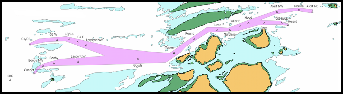
Figure 1: UKCM system monitoring area.
Data for vessels with an ‘active’ transit plan is updated every 30 seconds whilst in the UKCM monitoring area. This ensures that near real-time information about the existing and predicted water levels are provided throughout a vessel’s transit.
Chart overlay data is represented by red pixelation in the individual transit monitoring display for vessels. The red pixelation equates to areas where the UKCM system has calculated that AMSA’s minimum UKC requirement cannot be satisfied, taking into account the current environmental conditions and the observed / calculated speed of the vessel through the water.
The UKC warning layer data is represented by amber pixelation in the individual transit monitoring display for vessels. The amber pixelation equates to areas where the calculated UKC is between the AMSA’s minimum UKC requirement, and 0.2m above AMSA’s minimum UKC requirement. The amber pixelation generally reflects areas where the water is shallowing over time.
Where possible, coastal pilots of deep-draught vessels using the UKCM system ‘Deep Route’ option, should consider safely adjusting their planned track(s), to ensure the deep-draught vessel remains within the ‘Deep Route’ boundary, throughout the transit. The limits of ‘Deep Route’ boundary is shown as a red polygon in the chart overlay (figure 2).
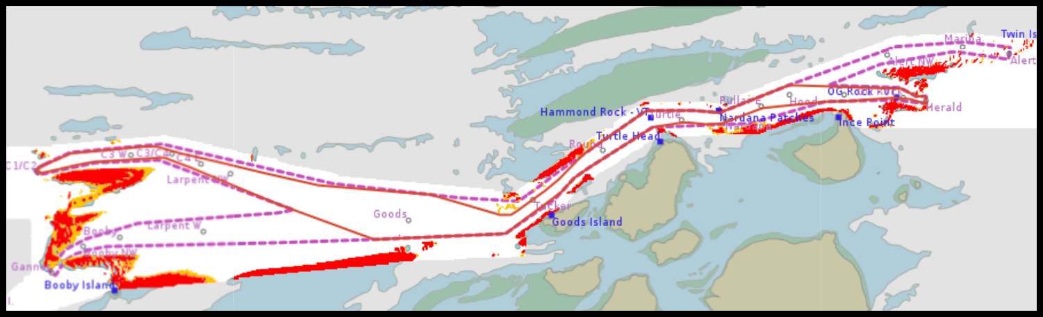
Figure 2: Deep Route boundary within the UKCM system monitoring area.
Training
Coastal pilots may only use the UKCM system following successful completion of:
- online training in the use of the UKCM system
- a practical competency assessment in the use of the UKCM system.
Further information
- Under keel clearance management for coastal pilots
- AMSA’s UKCM system: dukc.omcinternational.com
Contact
For further information relating to this PAN contact MSEC-CP@amsa.gov.au.