AMSA Connect phone services will be closed for the public holiday on Monday 8 June 2026, reopening on Tuesday 9 June 2026. Our search and rescue team will continue to operate during this time.
Showing 1 - 20 of 1112 results for WA 0859 3970 0884 Anggaran Dana Pasang Kitchen Set Bawah 2 Pintu di Ngaliyan Semarang
- Exercise Sea Dragon Phase 2—June 2012This exercise reviewed the effectiveness of a combined Commonwealth, Victorian and industry marine pollution response to a tied 3 pollution incident in Victorian state waters.Last updated: 11/09/2020
- Spatial dataWe provide access to spatial data that supports maritime and aviation safety activities and protection of the marine environment. You can download selected data sets, and request customised products and spatial analysis.Last updated: 11/17/2017
- Spatial data gatewayWe provide a range of geographic information as digital maps and spatial data sets. This visual geographic data is used to support search and rescue, pollution response, vessel tracking, and navigation in Australian waters. Some data access may require you to pay a fee.Last updated: 08/06/2020
- Engineer class 2This certificate enables you to work as an engineer on any propulsion power vessel in any operating area.Last updated: 07/10/2024
 Oceanic Grandeur, 3 March 1970The oil spill from the Oceanic Grandeur in Torres Strait in March 1970 highlighted Australia’s lack of preparedness at the time to deal with a major oil spill in the marine environment.Last updated: 11/09/2020
- Fuel oil consumption dataAll ships of 5,000 gross tonnage and above engaged in international voyages must collect data on fuel consumption, distance travelled and hours underway.Last updated: 11/07/2024
- Paying an infringement penaltyIf you have been issued with an infringement notice, you have 28 days to pay the infringement penalty or contact us about your payment options.Last updated: 02/11/2025
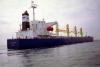 Pax Phoenix, 2 September 2001Following a report to AMSA, and subsequent investigation, the Pax Phoenix was fined for illegally discharging oily water into the marine environment near Holbourne Island, Queensland on 2 September 2001.Last updated: 11/09/2020
 Nella Dan, 3 December 1987On 3 December 1987 the Nella Dan ran aground in strong winds in Buckle Bay, Macquarie Island.Last updated: 11/09/2020
- Coxswain Grade 2 near coastalLearn about the Coxswain Grade 2 certificate, including the vessels it lets you operate, how to qualify, apply, or renew.Last updated: 05/29/2025
- Exemption 40 (Operational area) Determination —Schedule 2This map displays the specified Class 2C restricted or Class 3C restricted areas in Queensland.Last updated: 11/09/2020
- Vessel track data disclosure and dissemination policyThe purpose of this policy is to outline the underlying principles for the disclosure and dissemination of vessel tracking information under agreed conditions.Last updated: 01/21/2021
 Focused inspection campaign—passenger tender vessel safety (WA/NT only)Advice to vessel owners and masters for the Focused Inspection Campaign (FIC) on passenger (class 1) vessel tenders in Western Australia and Northern Territory.Last updated: 08/30/2023
- Marine Surveyors Manual—parts 1 and 2The Surveyor Accreditation Guidance Manual (SAGM) is a mandatory standard that outlines the requirements for accredited marine surveyors.Last updated: 02/04/2025
- Marine Engine Driver Grade 2 near coastalLearn about the MED 2 certificate, including the vessels it lets you operate, how to qualify, apply, or renew.Last updated: 07/17/2025
- Marine order 2—Australian International Shipping RegisterLast updated: 01/21/2021
- Drug and alcohol policy - Class 1, 2 and 3Learn how to develop a drug and alcohol policy for a Class 1, 2 or 3 vessel.Last updated:
- Exemption 40 (Operational area) Determination—Schedule 5, Figure 2This map displays the specified areas for Class 2C restricted or Class 3C restricted vessels greater than 4.25 metres and less than 5.5 metres in Tasmania.Last updated: 12/21/2023
 Now available: Updated Surveyor Accreditation Guidance Manual Part 2We have released the updated Surveyor Accreditation Guidance Manual Part 2 (SAGM2).Last updated: 11/27/2024
- Maritime Safety Awareness Bulletin issue 2—mooring safetyThinking mooring safetyLast updated: 09/29/2021